 Single-Map
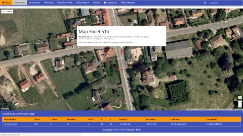
Street View
Multi-Map
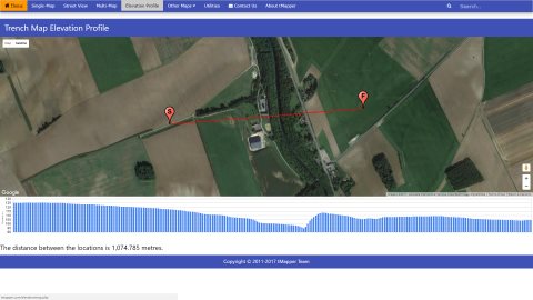
Elevation Profile
Place Search
Single-Map
Street View
Multi-Map
Elevation Profile
Place Search
Single-Map
Street View
Multi-Map
Elevation Profile
Place Search
Single-Map
Street View
Multi-Map
Elevation Profile
Place Search
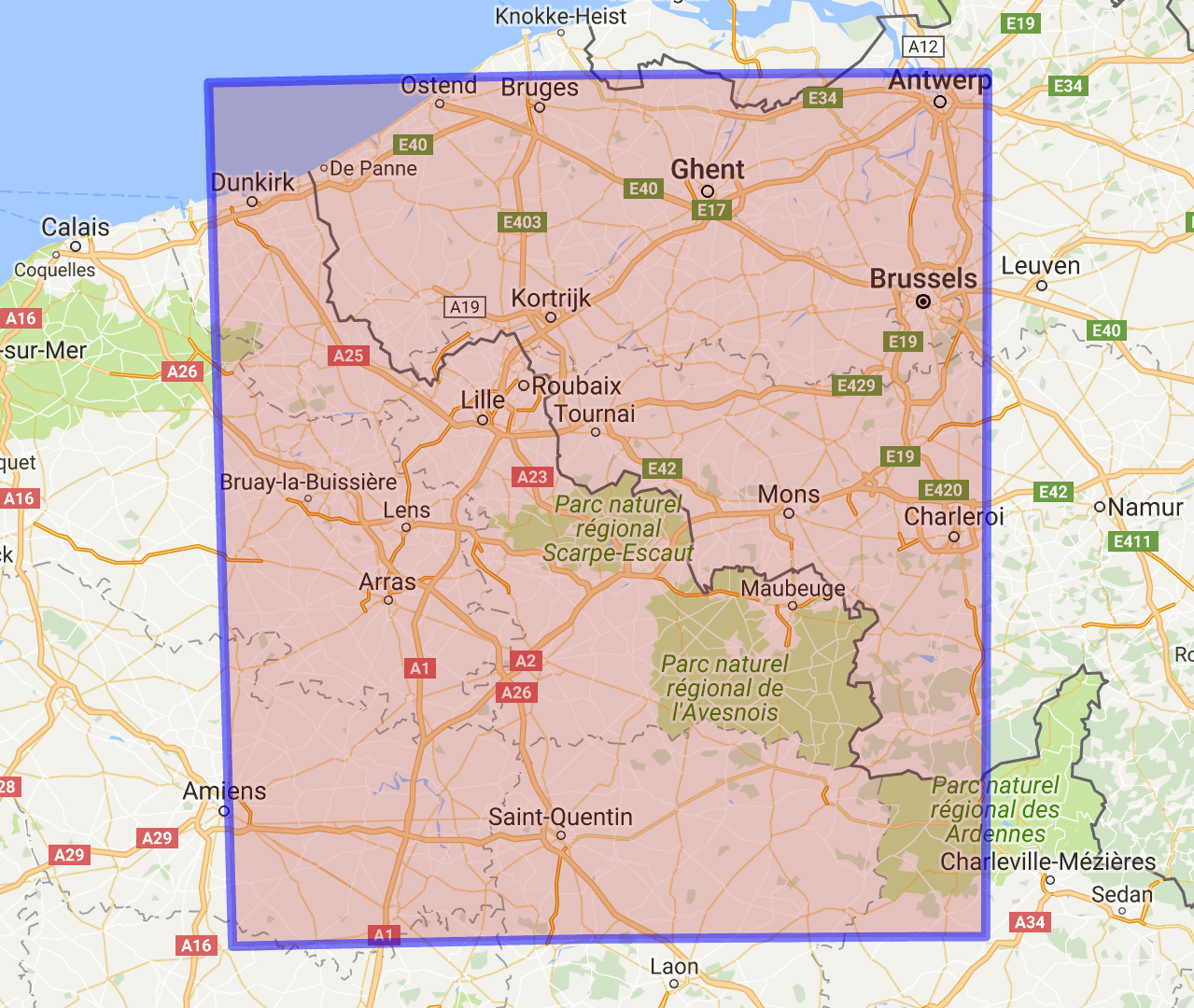
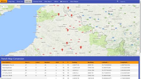
Select your map below, including the sheet name, reference letter, number, square and x, y value.Note: If the x, y value are single digit, eg Sheet 51b.A.8.a.4.7 then tMapper assumes x as 40, y as 70
During WW1, combatants surveyed thousands of square kilometres, painstakingly mapping key locations into a now forgotten reference system. One hundred years later, the tMapper Team have harnessed the power of Google Maps to project a trench reference onto a modern map.
Advanced users can select multiple conversions, view elevation profiles, navigate to a location and search for nearby trench systems